The historic High Seas Treaty allows countries, for the first time, to protect areas of the ocean that belong to no one. Walvis Ridge, a massive underwater mountain chain in the South Atlantic, is among the strongest candidates for that protection. To understand why — including the threats it faces and what it might take to enforce protections — OceanMind analysed three years of satellite and vessel-tracking data to establish who uses this stretch of ocean, when they use it, and what policing it would entail. This summary sets out what we did, what we found, and what it means.
You can download a PDF version of this executive summary here. The full 150-page assessment will be available upon request to government agencies, fisheries authorities, and other relevant organizations. To request a copy, please click here.
Walvis Ridge is a chain of large, underwater mountains running roughly 3,000 kilometres across the floor of the South Atlantic, from the Namibian coast to the Mid-Atlantic Ridge near Tristan da Cunha. Here, abyssal plains give way to towering seamounts, flat-topped guyots, steep canyons, and fossilised cold-water coral reef mounds, forming a submerged landscape as varied as any found on land. Its richest waters lie in the northeast, where the Benguela Current sweeps nutrients up from the deep, fueling a remarkably rich and diverse ecosystem.
Wherever researchers have looked, the ridge has delivered: one cruise alone recorded 175 fish species, 50 cephalopods, and 192 benthic invertebrates. Lophelia, gorgonian, and bamboo corals rise from its seamounts, and its productive waters draw globally threatened albatrosses, seabirds from the Tristan da Cunha islands, tuna, deep-water fish, sharks, and passing whales. While scientists are still mapping the full extent of these vulnerable marine ecosystems, few places on the high seas concentrate this much life in one stretch of ocean.
What makes Walvis Ridge biologically rich also makes it commercially valuable. Fishing fleets have traversed its waters for centuries, targeting prized deep-sea species like orange roughy and alfonsino (red bream). Because these species are long-lived and slow to mature, populations are slow to recover once they’ve been fished down. Bottom-contact gear can also instantly scar coral habitats that took hundreds of years to grow.
Establishing a Walvis Ridge marine protected area (MPA) would bring just over 1 million square kilometres of international waters under active management at a single stroke. This would be a major step towards the global target of conserving 30 percent of the ocean by 2030, and a powerful demonstration of how to make high seas protection a reality.
Roughly two-thirds of the ocean lies beyond the jurisdiction of any single country. Until recently, less than one percent of these high seas had any tangible protection, because no international body had the authority to create a fully protected area there. Entered into force in January 2026, the Biodiversity Beyond National Jurisdiction agreement (BBNJ, also known as the High Seas Treaty) changed that by providing the first legal route to designate marine protected areas in international waters.
Designation is an important legal act, but it only becomes effective with practical execution (i.e., protections enforcement). Walvis Ridge sits well beyond the reach of routine patrols, in an area where no coastal state has enforcement authority. Responsibility is instead fractured between vessel flag states, landing ports, and a patchwork of existing regional fisheries bodies. Deep-water species are overseen by the South East Atlantic Fisheries Organisation, which already maintains some closed areas around the ridge. Meanwhile, migratory species are governed by both the International Commission for the Conservation of Atlantic Tunas and the Commission for the Conservation of Southern Bluefin Tuna.
None of these entities were designed to protect biodiversity as a whole, and none can act alone. In truth, no international framework has yet demonstrated how to enforce a protected area of this size in international waters. This assessment aims to close that gap. Before anyone can police the ridge, they need to know who is there, when, and doing what.
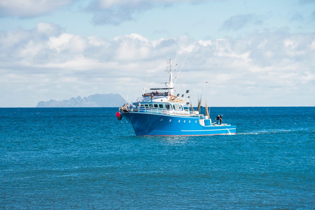
Because Walvis Ridge is invisible from shore, mapping its activity requires looking from space. Every method of satellite monitoring has unique strengths and distinct blind spots. To build a complete picture, we analysed three independent space-based data sources over a three-year period, extending analysis into an adjacent buffer zone around the proposed boundary to also capture activity just outside the line.
Our assessment relies on the following tracking methods:
Cross-referencing these three datasets reveals operational anomalies that are otherwise invisible. When a vessel is detected by nighttime lights or optical imagery, but is missing from self-reporting transponders, it flags a discrepancy. While a missing signal can sometimes be caused by a legitimate equipment failure, every such case warrants a closer look. In this study, an analyst manually reviewed each instance, cross-checking the findings against vessel registries, authorisation lists, and open-source records.
A note on data gaps: A fourth standard tool, satellite radar (aka synthetic aperture radar or SAR), would ordinarily complement these by seeing through cloud and darkness. It was not available over this part of the ocean during our study window. Because data over the remote high seas is frequently patchy, any effective monitoring system must be explicitly built to operate with these limitations.
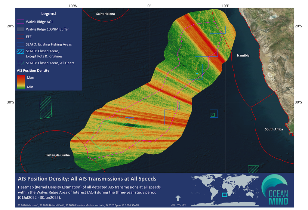
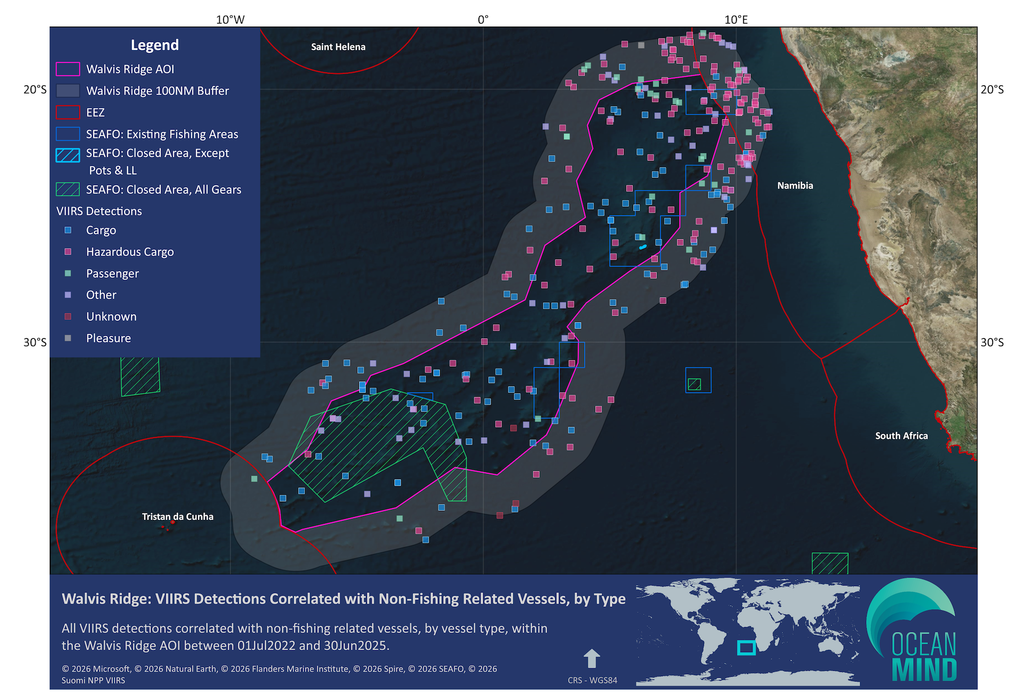
Cargo ships and tankers accounted for ~78 percent of all recorded traffic, following established trade routes around southern Africa. These trade routes include vessels destined to and/or coming from West Africa, Europe, and the Americas — thus traversing the area under consideration for a potential Walvis Ridge High Seas MPA.
This traffic grew by nearly 40 percent across the three years. Because any protected area here would sit astride a busy commercial corridor, it must accommodate lawful passage while managing the environmental risks of heavy traffic, including collisions and pollution. Marine protection and trade are not in conflict at Walvis Ridge, but they must be designed together.
Across the three years of data, we identified 743 individual fishing vessels, only a small fraction of the total traffic. However, their daily presence was consistently higher than their numbers suggest because the same vessels repeatedly returned to the same grounds. Most fishing pressure comes from a stable group of distant water fishing fleets working the ridge year after year, as opposed to a shifting population of newcomers. This stability streamlines monitoring, since a persistent, recognisable fleet is more predictable to track than a constantly changing one.
Fishing activity is more than three times higher in the southern hemisphere winter than in summer. Longline vessels, which set lines many kilometres long, rise from roughly 5 per day in the summer to 18 in the winter. The marker buoys attached to their gear, which carry their own transmitters, rise from almost none to more than 25 per day. Activity climbs in April, peaks in August, and falls away through the southern spring. This pattern provides a critical operational advantage, telling enforcement planners not only where to look, but when. Continuous, year-round monitoring of an area this size is financially prohibitive. Concentrating high-intensity monitoring into a predictable four-month window makes enforcement more achievable.
Around 1 in 8 signals on an average day (12.5%) came from a transmitter that could not be tied to a known vessel or piece of equipment. These unidentified signals rise and fall with the seasons in almost exactly the same pattern as the fishing fleet, indicating they likely stem from fishing gear or related operations. While these signals are not definitive proof of wrongdoing and are often routine, they present a clear data challenge: any assessment counting only known vessels will systematically understate total fishing activity.
Night-light detection recorded 1,530 sightings of vessels working after dark. Two-thirds of them (1,000 in total) could not be matched to any vessel transmitting a position at that time and place. More than half of those unmatched sightings were strong, clear detections versus marginal ones, and their frequency rose sharply over the three years. Separately, limited daytime satellite imagery revealed several unexplained vessels matching the size and shape of fishing boats — some operating near the boundaries of a year-round closure established by the South East Atlantic Fisheries Organisation. While these gaps do not prove illegal activity, they establish that relying on transponders alone leaves a substantial part of the picture missing.
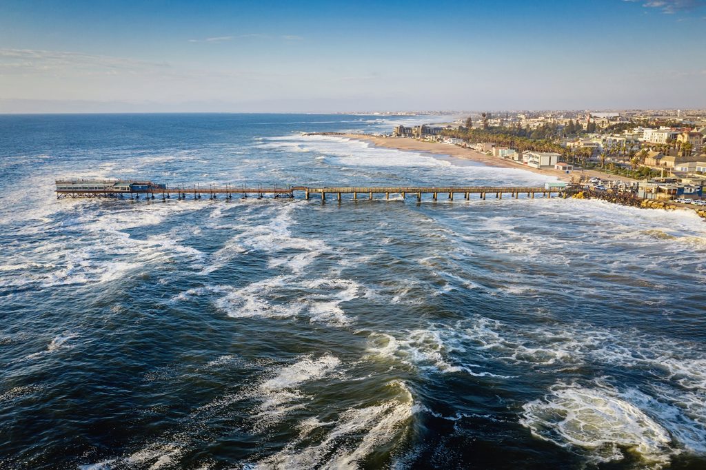
Closing these visibility gaps requires an operational strategy tailored to the unique realities of the high seas. Because no patrol vessel can station permanently over Walvis Ridge, and boarding ships at sea presents severe legal and safety obstacles, meaningful enforcement must ultimately happen in port.
Every vessel eventually enters a harbour to land its catch, file paperwork, and offload cargo. At that point, a port inspector armed with precise intelligence can check documentation, question the crew, and examine transfer and temperature records. This allows authorities to reconstruct what a vessel was really doing three months prior, thousands of kilometres out to sea.
To provide these inspectors with the targeted data needed to investigate specific vessels and identify potential illegal activity, this assessment sets out a framework built on interdependent principles:
The assessment recommends building this capability in four stages, including:
Each stage delivers independent value, which ensures progress even if funding and political commitment arrive incrementally.
The full strategic risk assessment includes a costed operating model driven by the seasonal data:
The operational model is governed by two clear parameters:
The full financial costing and operational assumptions are detailed in the full report.
Walvis Ridge is the subject of this work, but it serves a broader purpose. Dozens of international water sites are candidates for protection under the High Seas Treaty, and every one of them will face the same fundamental challenge: making the legal boundary a reality in practice.
For example, the Salas y Gómez and Nazca Ridges in the southeast Pacific are another potential High Seas MPA of comparable magnitude to Walvis Ridge. Just as Walvis Ridge extends from the Namibian coast of Africa to Tristan da Cunha, the Salas y Gómez and Nazca ridges extend from the Peruvian and Chilean coast of South America some 3,000 km to Rapa Nui (Easter Island). Enforcing an MPA here would likely face many of the same challenges as those we’ve identified for Walvis Ridge — with similar potential solutions and approaches to effective enforcement.
The methodology developed here is fully transferable. It establishes a clear blueprint for high seas conservation:
How this first generation of protected areas is handled will shape expectations for the future of the High Seas Treaty. The sites that endure will not be those simply defined by lines on a map, but backed from the outset by strong monitoring, rigorous analysis, and a direct pipeline to enforcement authorities.
Success at Walvis Ridge will deliver a proven, scalable template for the next generation of candidate sites, charting a course toward a protected and thriving global ocean.
The complete strategic risk assessment contains the underlying data analysis, seasonal and spatial modelling, and verified case studies of individual vessel tracking. It also provides the full monitoring framework and a detailed, costed operating model. This document is intended for:
We welcome the opportunity to discuss these findings, explore what operational implementation looks like for your institution, or apply this same risk-assessment methodology to other candidate sites worldwide.
You can download a PDF version of this executive summary here. The full 150-page assessment will be available upon request to government agencies, fisheries authorities, and other relevant organizations. To request a copy, please submit the form below. For questions, comments, or assistance, please contact the OceanMind team.